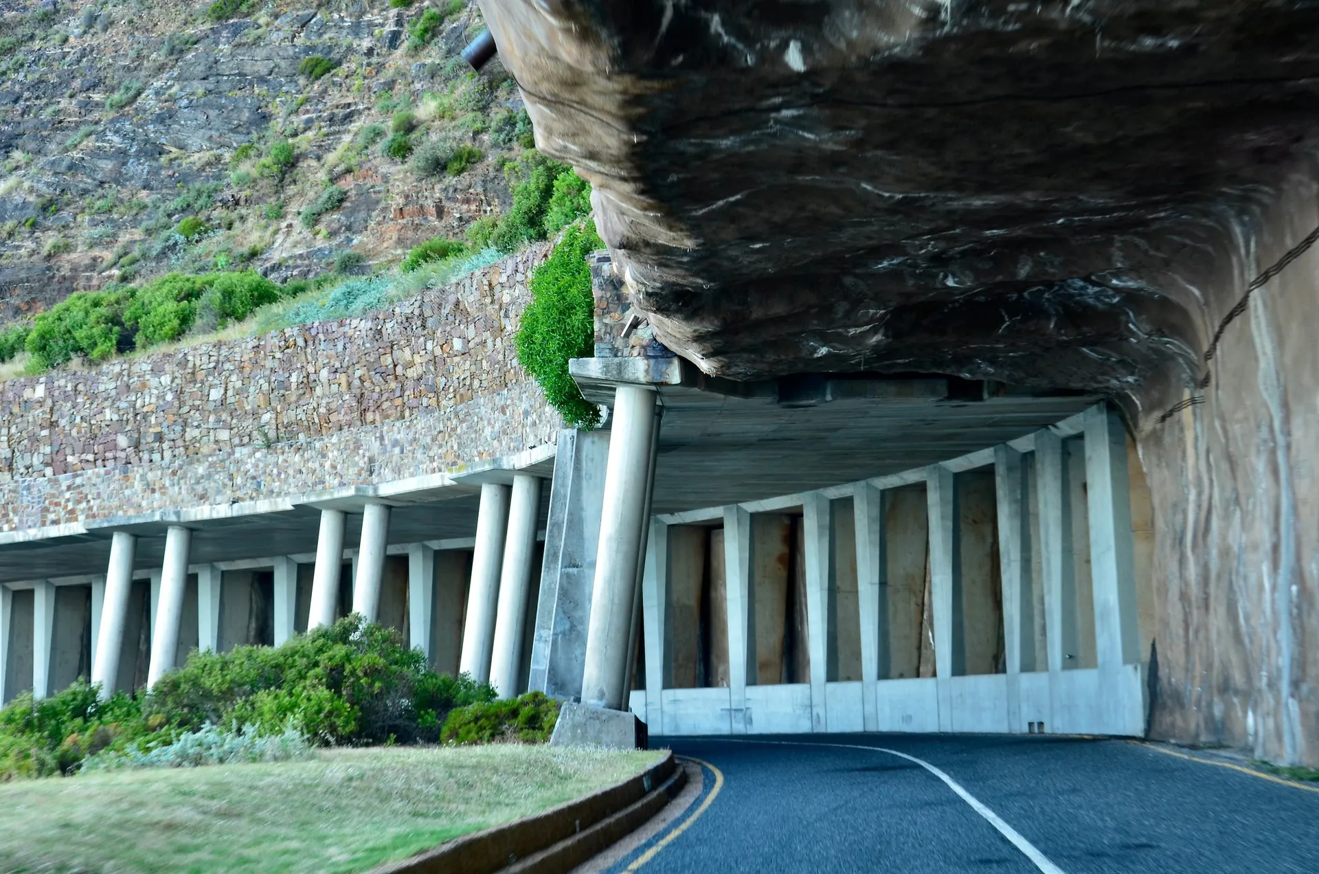
Chapman’s Peak Drive is a 9-kilometre stretch of road carved into the cliff face between Hout Bay and Noordhoek on Cape Town’s Atlantic coast. With 114 curves, viewpoints up to 600 metres above sea level, and scenery that makes grown adults gasp, it is regularly ranked among the most beautiful coastal drives in the world.
I drive this road several times a week with guests, and it never gets old. Here is everything you need to know before you go.
The Basics
- Length: 9 km
- Toll fee: R62 per car (as of 2025)
- Direction: You can drive it from either end, but northbound (Noordhoek to Hout Bay) gives the best views from the driver’s side
- Time needed: About 20 minutes without stops, but plan for 45 minutes to an hour with photo stops
- Open hours: The road is open daily but closes in severe weather or rockfall risk. Check the status before you go.
When to Go
The best time for photography is late afternoon, roughly 3pm to 5pm, when the sun lights up the cliffs in warm golden tones and the ocean below turns a deep cobalt blue. Morning light is also beautiful, particularly if you are heading south toward Cape Point.
Winter brings dramatic cloud formations and moody skies that photographers love, though the road closes more frequently due to weather. Summer offers reliable sunshine but the strong south-easterly wind can make viewpoint stops breezy.
My favourite time: A clear autumn afternoon in March or April, when the light is soft, the wind is gentle, and the crowds are thin.
Best Photo Stops
There are several pull-off viewpoints along the drive. Here are the three I always stop at with guests:
-
The first viewpoint heading south from Hout Bay (about 1 km in). This gives you the classic postcard shot looking back over Hout Bay harbour with the Sentinel peak behind.
-
The midpoint lookout (roughly halfway). This is where the road reaches its highest point, and you can see both Hout Bay behind you and the long sweep of Noordhoek Beach ahead. On a clear day, Cape Point is visible in the distance.
-
The Noordhoek end, looking back at the road you have just driven. The full sweep of the cliff-face road is visible from here, snaking along the mountain above the ocean.
History
Chapman’s Peak Drive was built between 1915 and 1922 by convict labour, following a route first surveyed by the British military in 1895. The engineering was remarkable for its time, with the road literally chiselled into the mountain’s granite and sandstone cliffs.
The drive is named after John Chapman, an English sailor who was the second mate on the ship “Consent.” He was killed in a skirmish with local Khoikhoi people near this spot in 1607.
Practical Tips
- Pay the toll in cash or card. Both are accepted at the toll booth.
- Watch for cyclists. Chapman’s Peak is popular with road cyclists, especially on weekend mornings. Give them space.
- Do not stop in the road. Use the designated viewpoints. The road is narrow with blind corners.
- Combine it with Cape Point. Chapman’s Peak is the natural start to a full-day Cape Peninsula tour. Drive it on the way to Cape Point and return via the False Bay coast for a different perspective.
Is It Worth the Toll?
Absolutely, without question. The R62 toll is one of the best-value experiences in Cape Town. You get one of the world’s most spectacular drives, multiple viewpoints, and memories that will last far longer than the cost of a coffee.
If you are doing a Cape Point day trip, Chapman’s Peak Drive is the route you want to take. It is the difference between simply getting to Cape Point and making the journey itself part of the experience.